Underground pipeline measurement
Underground pipeline measurement
Concept
The investigation of underground pipelines includes the collection and organization of data on the current status of underground pipelines, and the use of logging, exploration, and pit exploration methods to conduct on-site investigations of unknown underground pipelines. The underground pipeline map is based on the terrain on both sides of the pipeline, representing the locations of various underground pipelines. Underground pipeline maps are divided into comprehensive pipeline maps, various professional pipeline maps, pipeline type maps, pipeline length maps, pipeline width maps, pipeline condition maps, pipeline condition evaluation maps, etc.
Underground pipeline measurement method
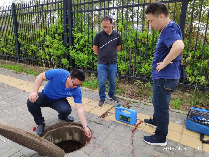
There are three methods for measuring underground pipelines:
- Using logging method: Logging method refers to excavating, drilling, excavating, measuring and other means to excavate the wellhead of underground pipelines in the terrain on both sides of the underground pipeline, and then measuring the length, width, condition, etc. of the underground pipeline.
- Adopting detection method: Detection method refers to detecting the position, length, width, condition, etc. of underground pipelines in the terrain on both sides of the underground pipeline through detection, measurement, recording and other means.
- Adopting pit probing method: Pit probing method refers to excavating pits for underground pipelines in the terrain on both sides of the underground pipeline through excavation, drilling, excavation, measurement and other means, and then measuring the length, width, condition, etc. of the underground pipeline.
Underground pipeline measurement steps
- Data collection: Collect information on the current status of underground pipelines, including the terrain on both sides of the pipeline, the location, length, width, and condition of the pipeline.
- Data organization: Organize the current status of underground pipelines, including the terrain on both sides of the underground pipelines, the location, length, width, and condition of the underground pipelines.
- Using logging method: Using logging method, excavate the wellhead of the underground pipeline, and then measure the length, width, condition, etc. of the underground pipeline.
- Adopting detection method: Using detection method to detect the position, length, width, condition, etc. of underground pipelines.
- Use pit probing method: Use pit probing method to excavate pits for underground pipelines, and then measure the length, width, condition, etc. of the underground pipelines.
- Draw underground pipeline map: Draw underground pipeline maps, including comprehensive pipeline maps, various professional pipeline maps, pipeline type maps, pipeline length maps, pipeline width maps, pipeline condition maps, pipeline condition evaluation maps, etc.
- Evaluate the condition of underground pipelines: Evaluate the condition of underground pipelines, including pipeline condition evaluation maps, pipeline condition evaluation reports, etc.
Typical case
Underground pipeline detection in Chang'an District
The pipeline surveying area is used to detect water supply, drainage (rainwater, sewage, rainwater sewage combined pipes), reclaimed water, gas, heat, electricity (except for lighting), communication, long-distance pipelines, industrial pipe trenches, other specialized pipelines, and unknown pipelines buried under urban roads. The Party A designates a 1:500 strip topographic map of the road for surveying. Pipeline surveying scope: 320 meters of Sports East Street, 412 meters of Ronghua Street, 490 meters of Shilipu Street, 1246 meters of Hemu Road, 1917 meters of Gucheng East Road, and 803 meters of Tiantai Road Pipeline surveying requirements: The accuracy of pipeline surveying must meet the relevant national regulations and technical standards. It is necessary to accurately detect various underground pipelines (water supply, drainage, power, telecommunications, mobile, China Unicom, military optical cables, cable TV, sky network, gas, heat, industrial pipelines), civil defense engineering, underground passages (corridors), etc. within the measurement area. It is necessary to investigate the plane position, burial depth, direction, nature, specifications, materials, number of pipe block holes, number of used holes, pressure, voltage, ownership unit, construction year, and other contents of various underground pipelines
Chang'an District Urban Construction Plan Road Construction Project Pipeline Detection
 It is necessary to accurately detect various types of pipelines buried under urban roads within the survey area, including water supply, drainage, reclaimed water, electricity, telecommunications, mobile, China Unicom, military optical cables, cable TV, air network, gas, heat, long-distance pipelines, industrial pipelines, etc. The plan position, burial depth, direction, nature, specifications, materials, number of pipe block holes, number of used holes, pressure, voltage, ownership unit, construction year, etc. of various underground pipelines need to be identified. Complete project terrain mapping, pipeline detection, and layout distribution map.